|
||
|
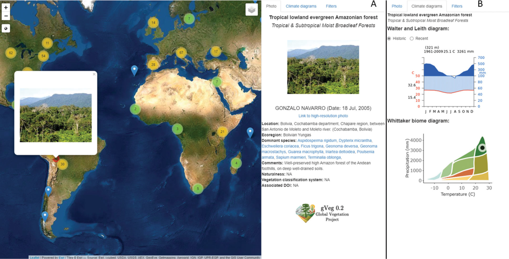
Screen shot of the online map application at http://gveg.wyobiodiversity.org illustrating a photo from a tropical lowland evergreen Amazonian forest in Bolivia (photo by Gonzalo Navarro, used with permission) within the pop up feature (on the left) and the photo metadata on right (A). Whereas (B) illustrates the historic and recent climate of the area in a Walter and Leith climate diagram and its location in a Whittaker biome diagram. Note that users can turn on additional global layers, including mean annual temperature and precipitation, elevation, aridity (MAP:PET ratio), biomes, and ecoregions. For clarity, we do not display the spatial filters tab here. |