|
||
|
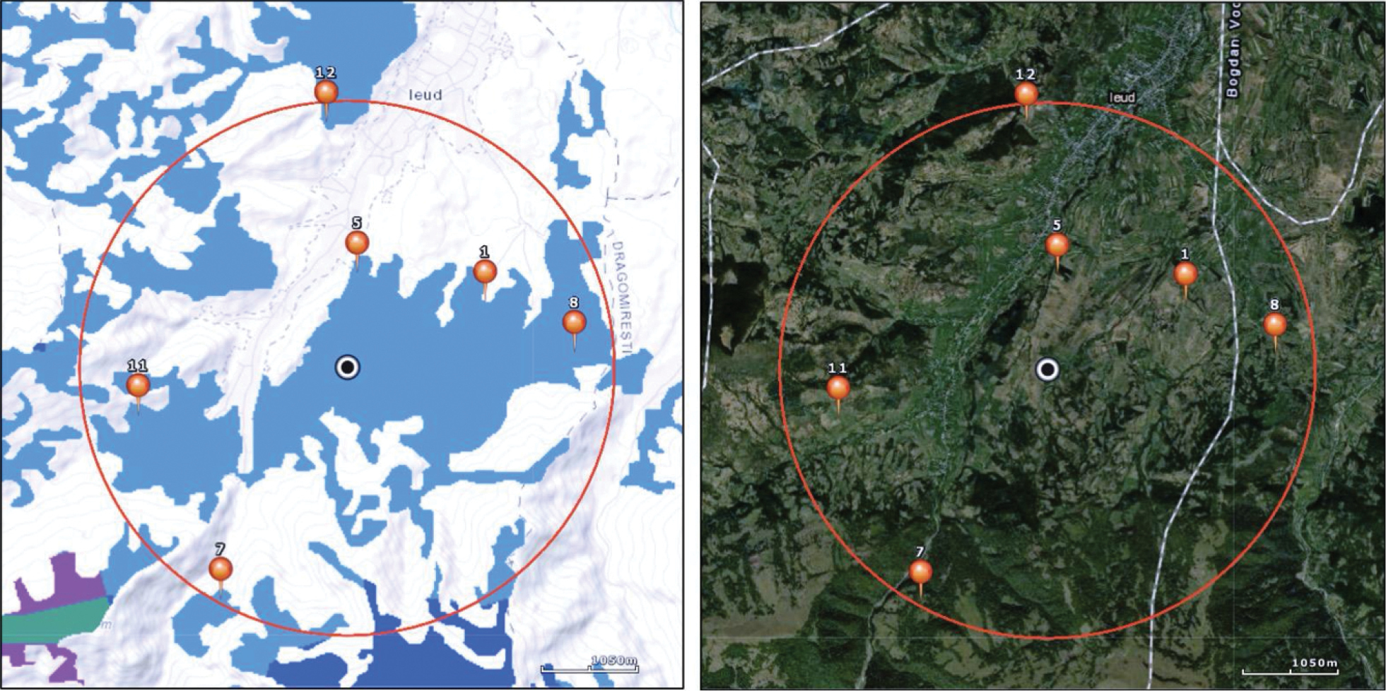
Sampling design within a site. Design consists of a circle of 25 km2 with a minimum of 10% managed grassland area. Topographic map is used for stratified random selection of sampling plots (red pins with numbers): two in a flat area, one on a moderate W-N-E slope, one on a steep W-N-E slope, one on a moderate E-S-W slope and one on a steep E-S-W slope. Sampling plots are selected exclusively in the CORINE grassland habitats (blue-coloured patches) and a satellite map is used to check the active land-use and avoid abandoned land parcels. |