|
||
|
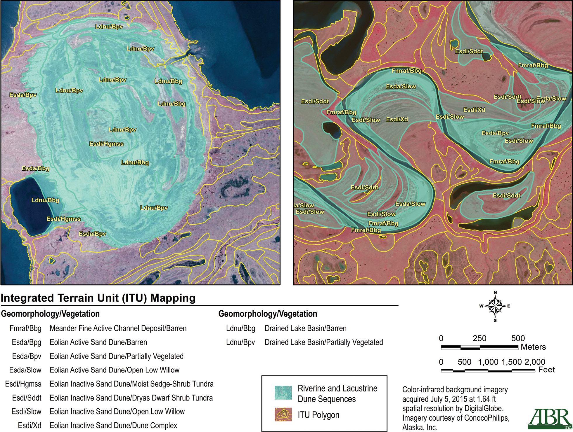
Examples of inland dune landscapes in a recently drained lake basin from the sand sheet region of the Beaufort Coastal Plain (left panel) and on the floodplain of Judy Creek (right) showing the Integrated Terrain Unit (ITU) map unit polygons and geomorphic unit and vegetation class assignments from Wells et al. (2020) over high-resolution satellite imagery from July 2018. The latitude and longitude (WGS84) of the centroids of each panel are as follows: Left panel 70.336953 -152.310269; Right panel 70.119314 -152.248539, ELD Arctic association classification, Alaska. |