| |
| |
|
|
| |
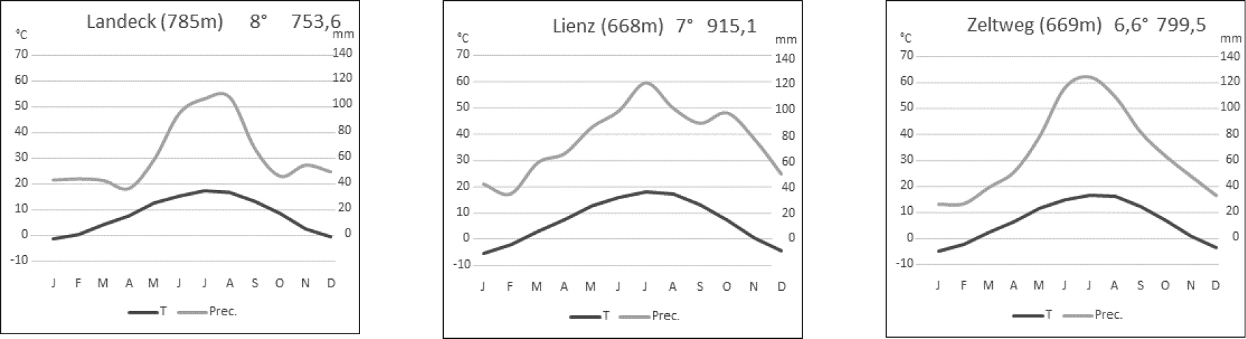
Climate diagrams from weather stations adjacent to the study sites (from west to east): The Upper Inn valley (Landeck), East Tyrol (Lienz, the closest ZAMG climate station to the Virgen valley), and the Mur valley (Zeltweg), based on data period 1971–2000 (ZAMG 2020). T: mean monthly temperature, Prec.: mean monthly precipitation.
|
|
|
|
| |
Part of: Magnes M, Willner W, Janišová M, Mayrhofer H, Afif Khouri E, Berg C, Kuzemko A, Kirschner P, Guarino R, Rötzer H, Belonovskaya E, Berastegi A, Biurrun I, García-Mijangos I, Masic E, Dengler J, Dembicz I (2021) Xeric grasslands of the inner-alpine dry valleys of Austria – new insights into syntaxonomy, diversity and ecology. Vegetation Classification and Survey 2: 133-157. https://doi.org/10.3897/VCS/2021/68594
|
|