|
||
|
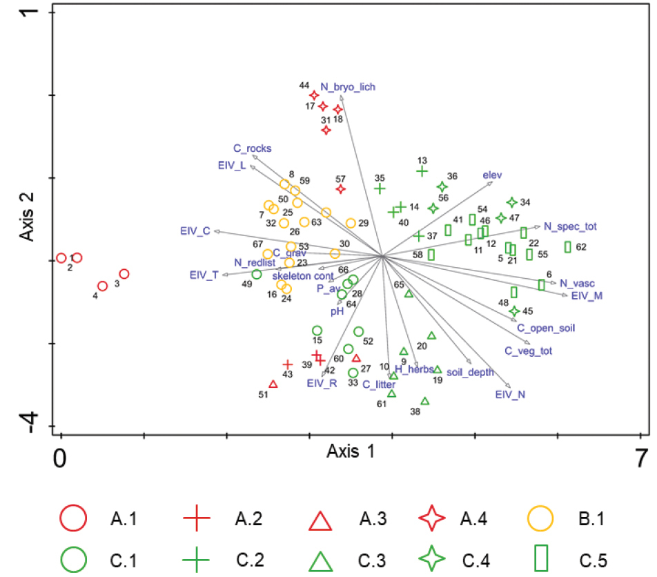
DCA of the 10-m2 plots sampled during the 11th EDGG Field Workshop (gradient length/eigenvalue/cumulative explained variation of Axis 1: 6.12/0.646/8.56, Axis 2: 3.70/0.4086/13,97). A.1–C.5: clusters according to the order/association code in Table 1, Suppl. material 2: red: Stipo-Festucetalia pallentis (A), yellow: Festucetalia valesiacae (B), green: Brachypodietalia pinnati (C); vectors: C_grav: cover of gravel; C_litter: cover of litter; C_open_soil: cover open soil; C_rocks: cover of rocks and stones; C_veg_ot: total vegetation cover; elev: elevation; EIV_C: Ellenberg indicator value for continentality; EIV_L: Ellenberg indicator value for light; EIV_M: Ellenberg indicator value for moisture; EIV_N: Ellenberg indicator value for nutrients; EIV_R: Ellenberg indicator values for soil reaction; EIV_T: Ellenberg indicator values for temperature; H_herbs: maximum height of herbs; N_bryo_lich: species number of bryophytes and lichens; N_redlist: number of red-list species; N_vasc: number of vascular plant species; N_grass: number of grass species; N_spec_tot: total species number; P_av: available Phosphor; skeleton con: skeleton content. The numbers show the position of the plots (For TURBOVEG numbers, see Suppl. material 1). |