|
||
|
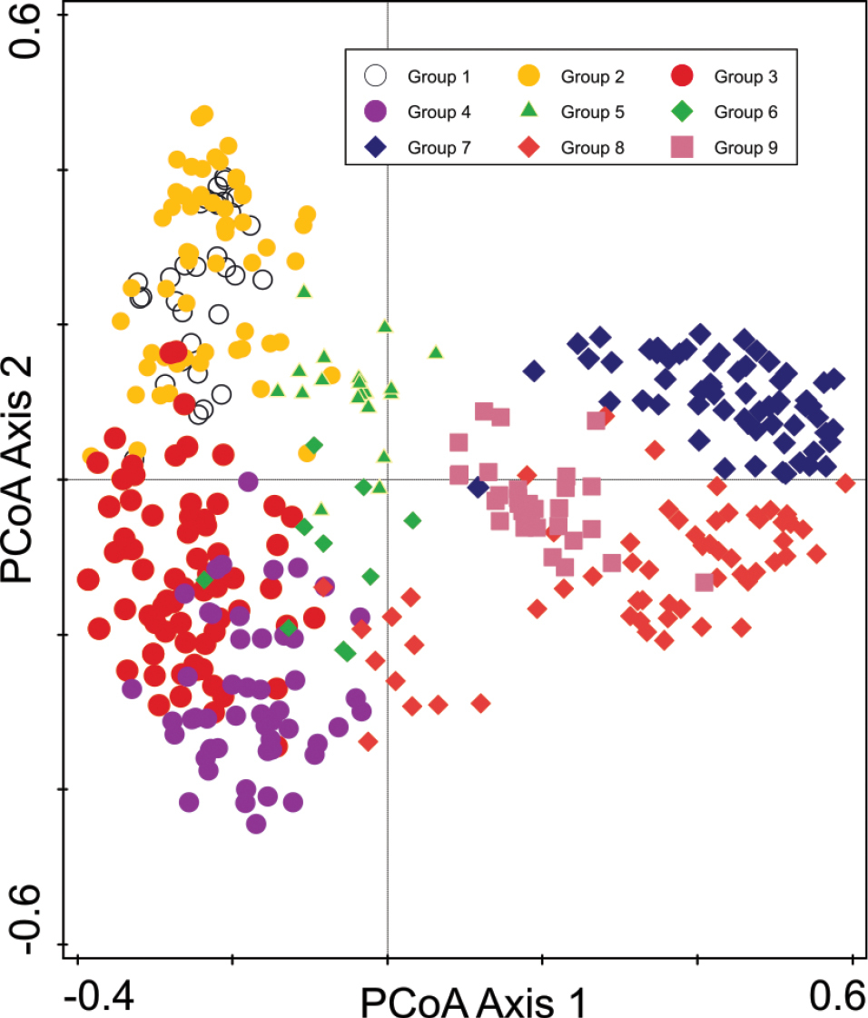
PCoA diagram for the 399 vegetation plots of tall-herb communities in the Sudetes Mts. and their foothills (SW Poland). The numbers of clusters are identical with Figure 2. Clusters 1 and 2 refer to submontane communities on nutrient-rich, Quaternary deposits; cluster 3 and 4 represent phytocoenoses in shaded sites, located within forest stands in the lower alpine zone; clusters 5 to 9 represent light-demanding and slightly acidophilic phytocoenoses developing from the subalpine to lower alpine zone. Symbols are grouped in alliances: circles: Petasition officinalis: 1 – Geranio phaei-Urticetum, 2 – Petasitetum hybridi, 3 – Chaerophylo hirsuti-Petasitetum albi; 4 – Prenanthetum purpureae; triangles: Rumicion alpini: 5 – Rumicetum alpini; diamonds: Calamagrostion villosae: 6 – Poo chaixii-Deschampsietum, 7 – Athyrietum filicis-feminae, 8 – Crepido conyzifoliae-Calamagrostietum; squares: Adenostylion alliariae: 9 – Cicerbitetum alpinae. |