|
||
|
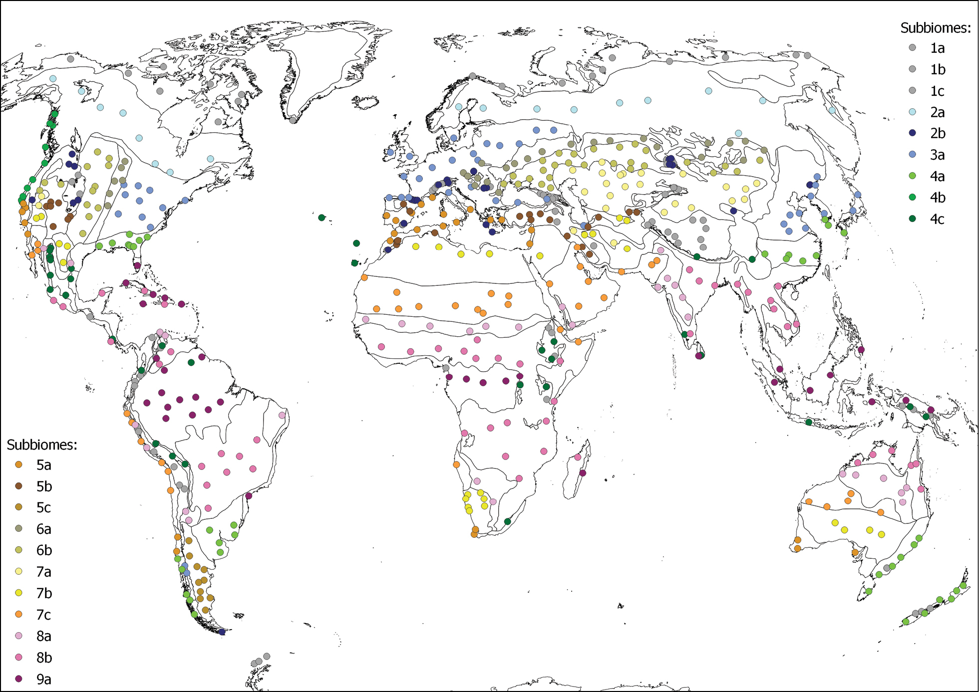
Distribution of the 616 localities from which climatic data have been obtained by means of CHELSA. The colors of the dots correspond to the 20 subbiomes and the lines are subbiome boundaries: 1a Polar tundra, 1b Tundras of the temparate mountains in cryoro belt, 1c Tundras of the tropical mountains in cryoro belt, 2a Lowland boreal Taiga, 2b Forests and shrublands of the temperate oro belt, 3a Temperate deciduous forests, 4a Lauroid evergreen forest of the lowlands, 4b Conifer coastal forests, 4c Tropical montane cloud lauroid and conifer evergreen forest, 5a Oceanic sclerophyllous-microphyllous evergreen forests and shrublands (Mediterranean), 5b Continental scrub and woodlands, 5c Patagonian shrubland, 6a Forest-steppe, 6b Grass-steppe, 7a Cold deserts and semi-deserts, 7b Temperate deserts and semi-deserts, 7c Warm deserts and semi-deserts, 8a Tropical xeric shrublands and woodlands, 8b Tropical pluviseasonal forests and woodlands, 9a Tropical rain forests. |